Skip to content
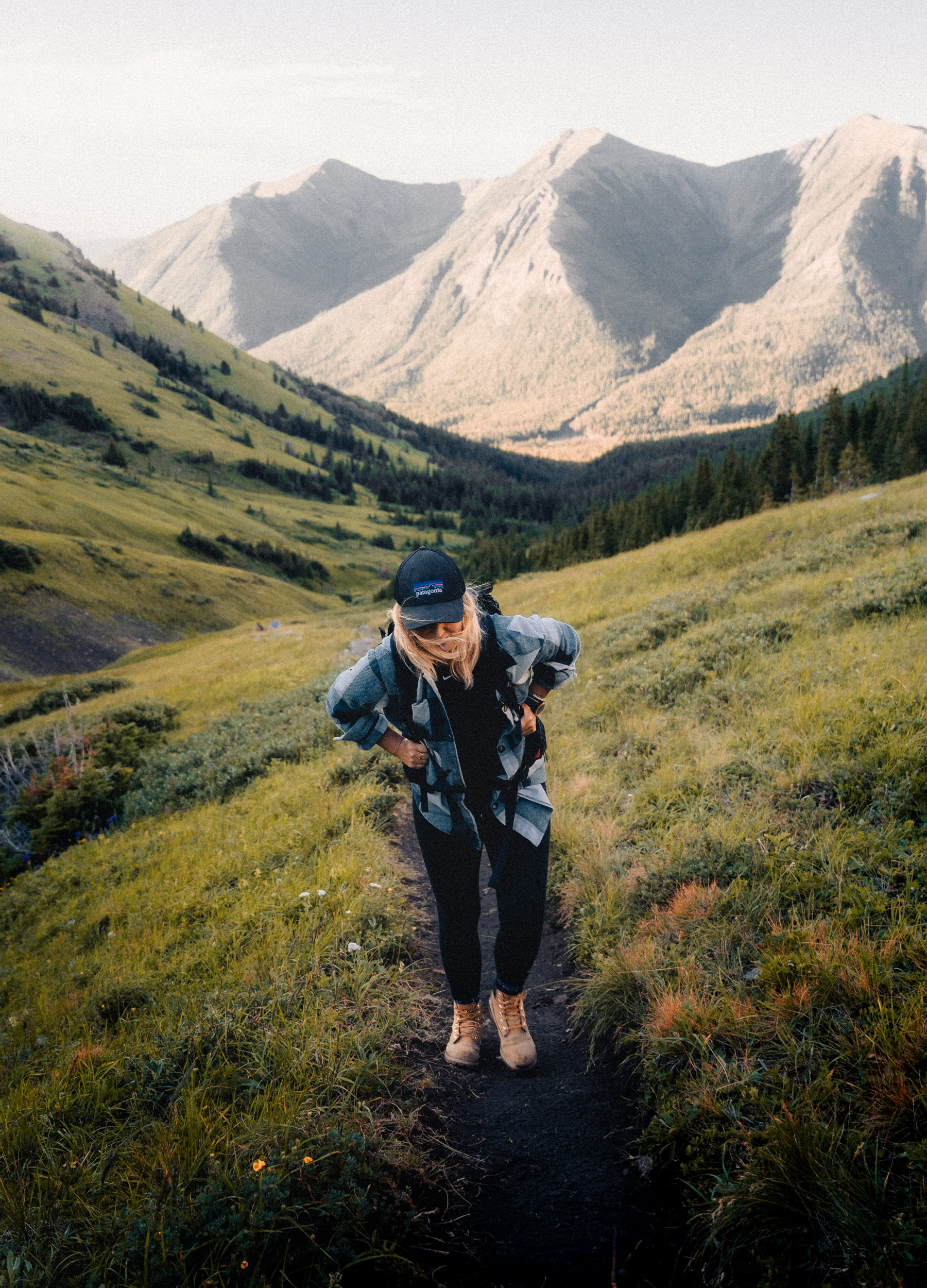
Mist Mountain Spring Trail
A beautiful hike with a small 'hot spring' on a mountainside
Trail Name
Mist Mountain Spring Trail
Mountain Name
Mist Mountain
Location
Kananaskis, Alberta, Canada
Date Hiked
Saturday, August 13th, 2022
Conditions
Dry, Partially Cloudy
Temperature at Summit
24°C
Start Time
6:30 am
Duration to Springs
1hr 50min
Duration (with Return)
3hr 45min
Distance to Springs
3.2km
Total Distance (with Return)
6.4km
Route Type
Out & Back
Total Ascent (Elevation Gain)
560m
Hiking Poles
Not required, recommended
Dog Friendly
Yes
Outhouse
No (Neither at parking or along trail)
Parking
Side of Highway
Distance From Calgary
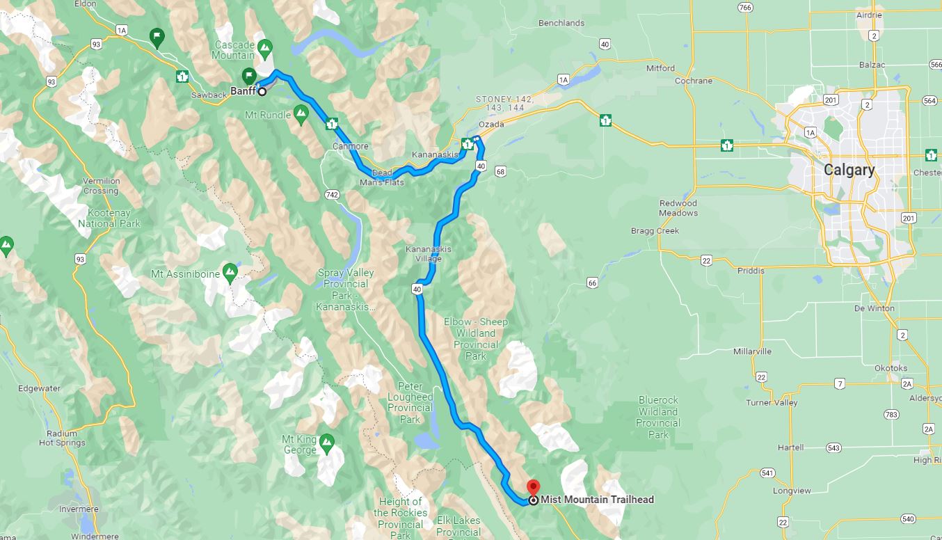
2hrs, 150km (Roughly same distance from Banff and Calgary)
Difficulty
★★☆☆☆
Rating (Reward)
★★★☆☆
Best Season
Spring, Summer, Fall (Hwy 40 Road closure Dec 1 – Jun 14)
Trail Name
Mist Mountain Spring Trail
Mountain Name
Mist Mountain
Location
Kananaskis, Alberta, Canada
Date Hiked
Saturday, August 13th, 2022
Conditions
Dry, Partially Cloudy
Temperature at Summit
24°C
Start Time
6:30 am
Duration to Springs
1hr 50min
Duration (with Return)
3hr 45min
Distance to Springs
3.2km
Total Distance (with Return)
6.4km
Route Type
Out & Back
Total Ascent (Elevation Gain)
560m
Hiking Poles
Not required, recommended
Dog Friendly
Yes
Outhouse
No (Neither at parking or along trail)
Parking
Side of Highway
Distance From Calgary
2hrs, 150km (Roughly same distance from Banff and Calgary)
Difficulty
★★☆☆☆
Rating (Reward)
★★★☆☆
Best Season
Spring, Summer, Fall (Hwy 40 Road closes between Dec 1 – Jun 14)
Trailhead Directions:
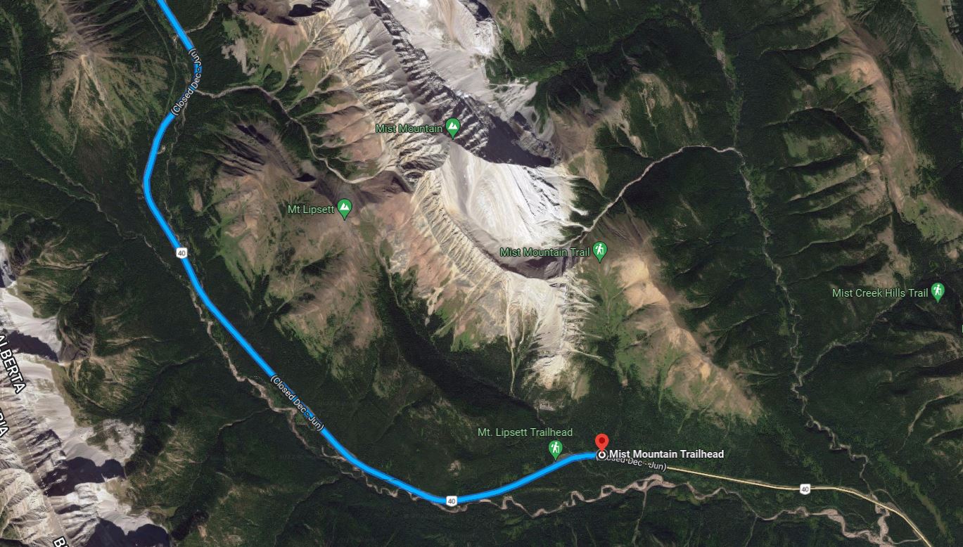
Heading from Banff/Canmore, travel Eastbound on highway 1 towards Calgary. If starting from Calgary, head Westbound towards Banff. Approximately halfway between Banff and Calgary is highway 40 which heads Southbound through Kananaskis, take this route for about an hour. Finding the trail can be tricky as there are no markers and no designated parking spots, as most park on the side of the road. Cell phone service is also inaccessible, so checking directions beforehand is key. Map directions to Mist Mountain Springs Trailhead, but if it cannot be found drive towards Mist Mountain. The highway will bend around in a long counterclockwise direction. Follow this route until you pass a parking lot on the left side of the road – This is not the trailhead, this is for Mt. Lipsett. Continue driving down the road for about a minute. When you reach the part of the road that widens out into multiple lanes for ‘parking’, you’ve done too far. Spin around and drive back about 50m. If there is no one there, it might be hard to spot the faint trail going through the bushes.
Trailhead Coordinates: 50.522814° N, 114.883516° W
The Hike:
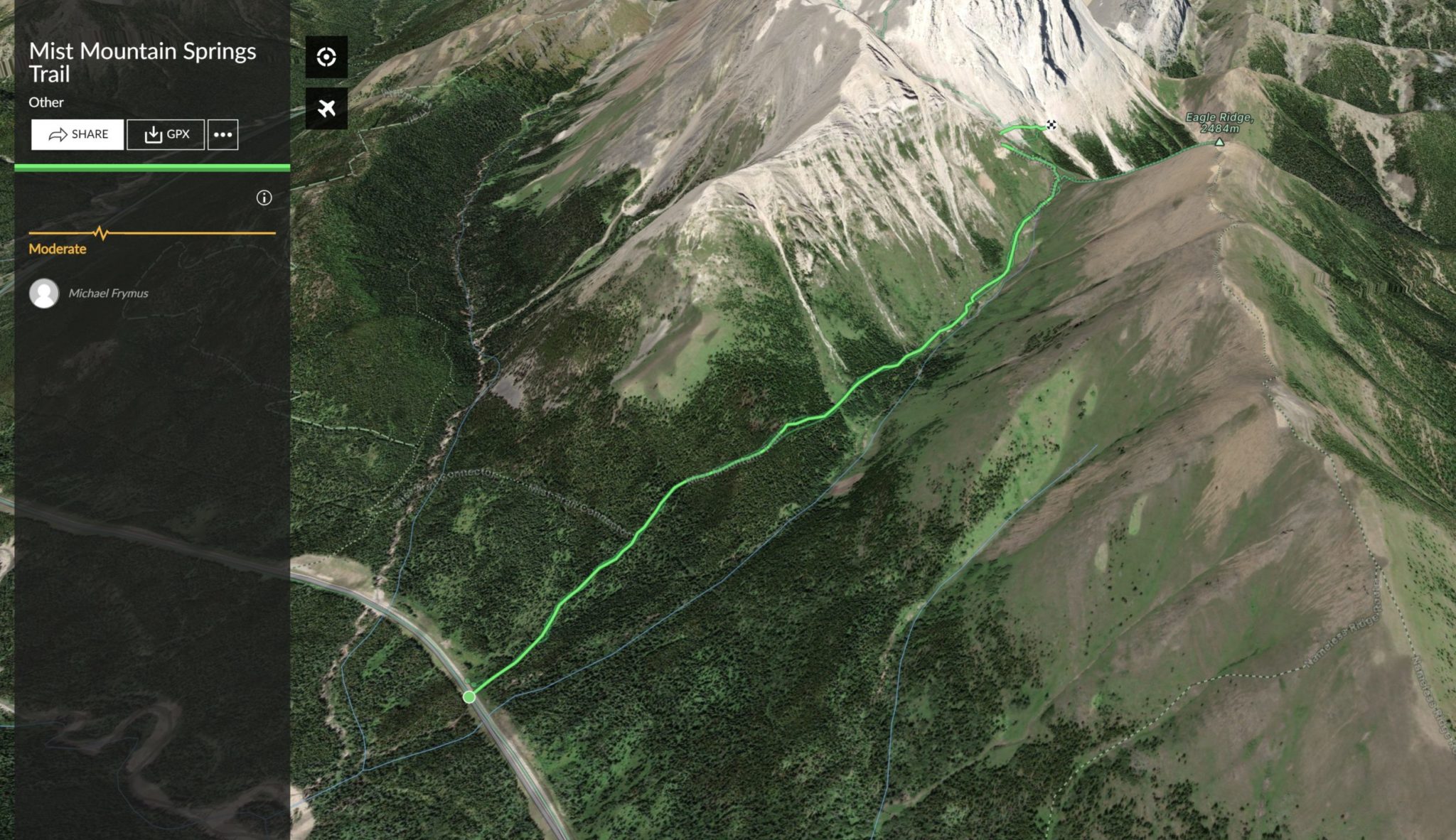
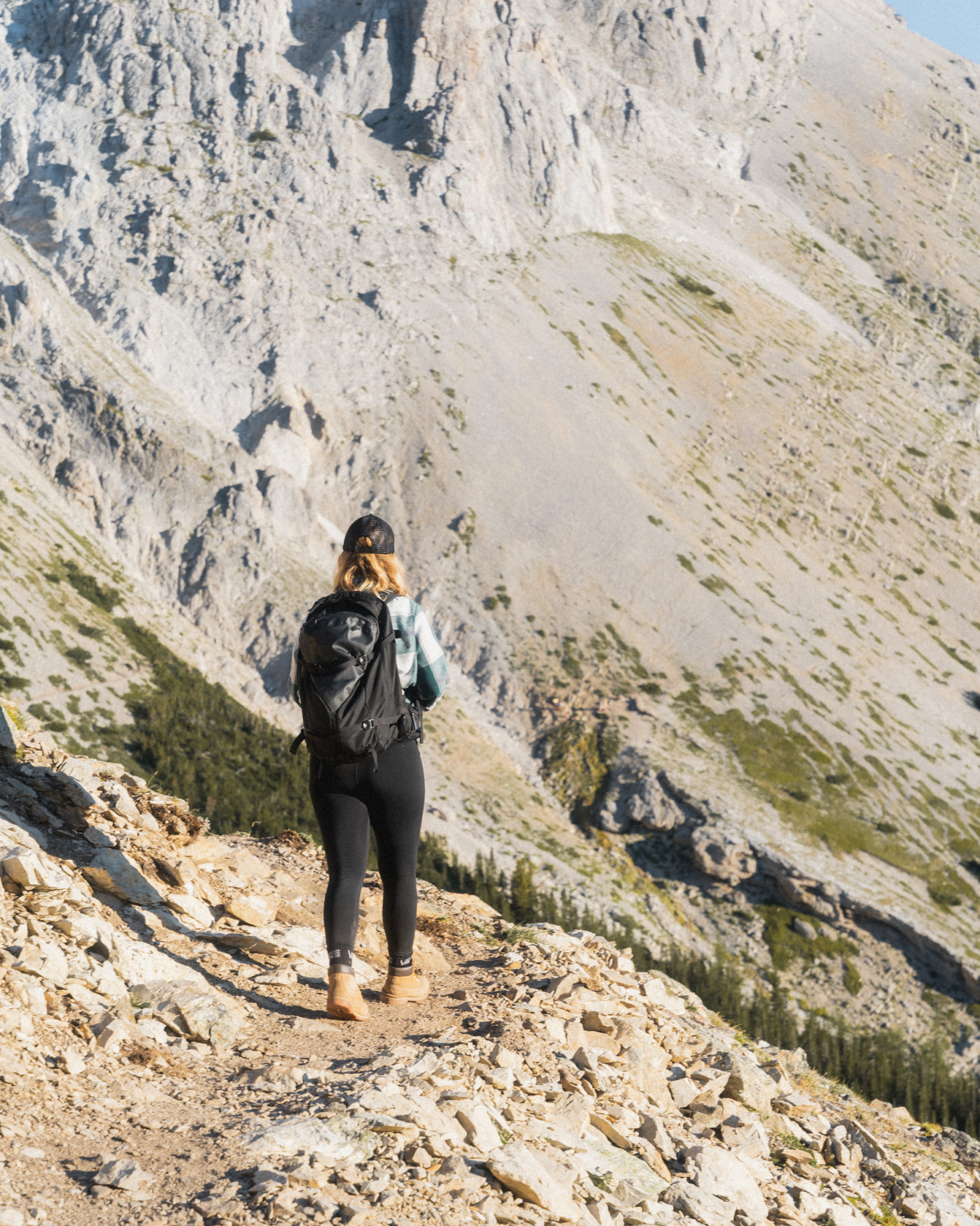
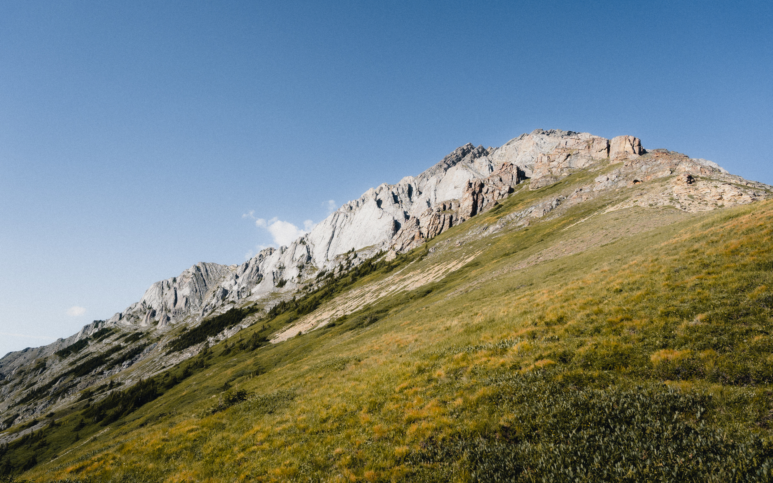
Hiking up the Mist Mountain Spring Trail starts off rather steep, hiking through a forested area for the first kilometre. Eventually, the gradation becomes less severe as you walk through the open valley between two mountains. This is when you get some really lovely views from the jaggedy and rocky cliffs on the left to the grass-filled mountains on the right. The ascent to the peak is gradual, easy to follow, and does not have any challenging sections. We’ve seen kids, dogs, and older couples walk up this section with ease.
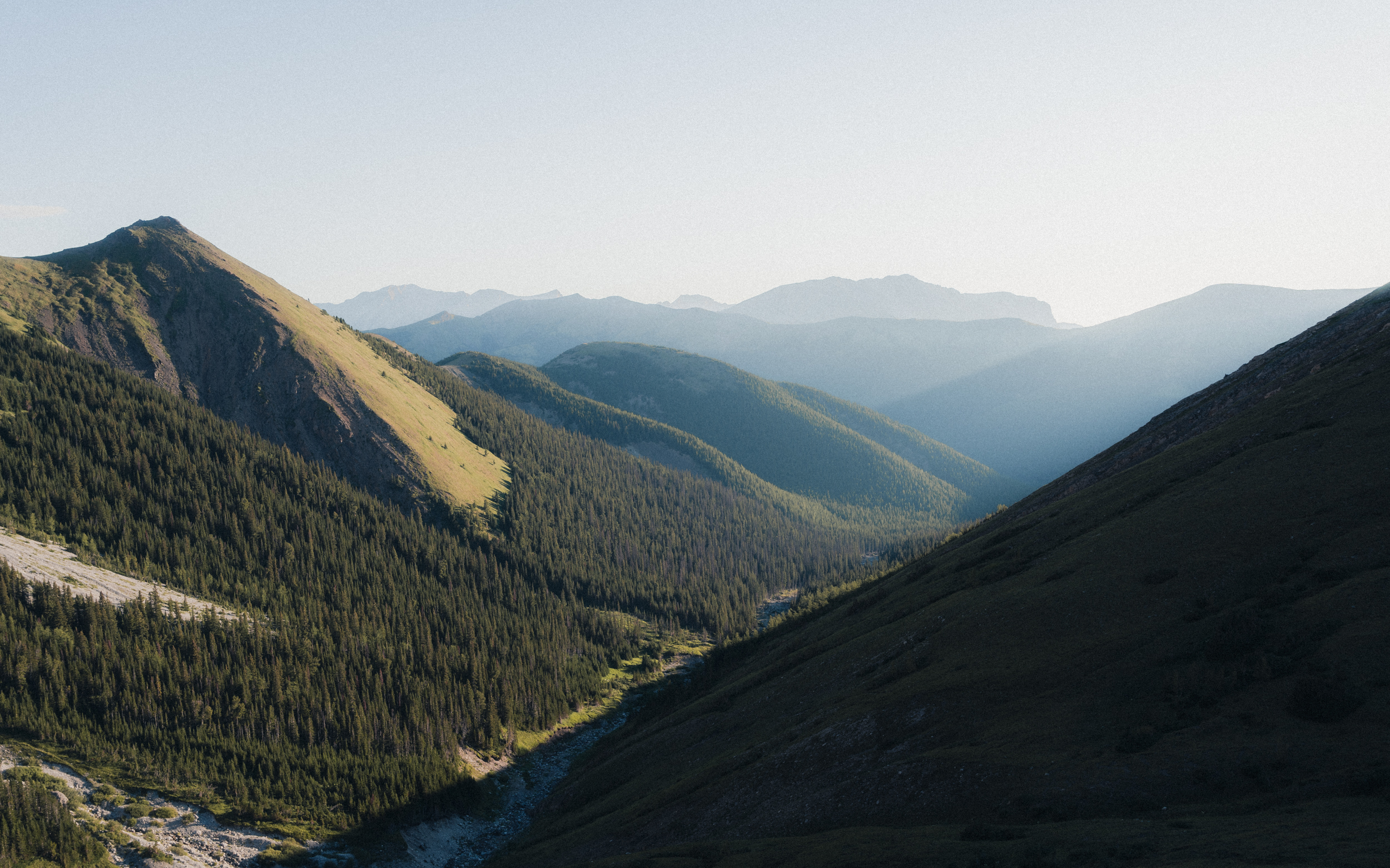
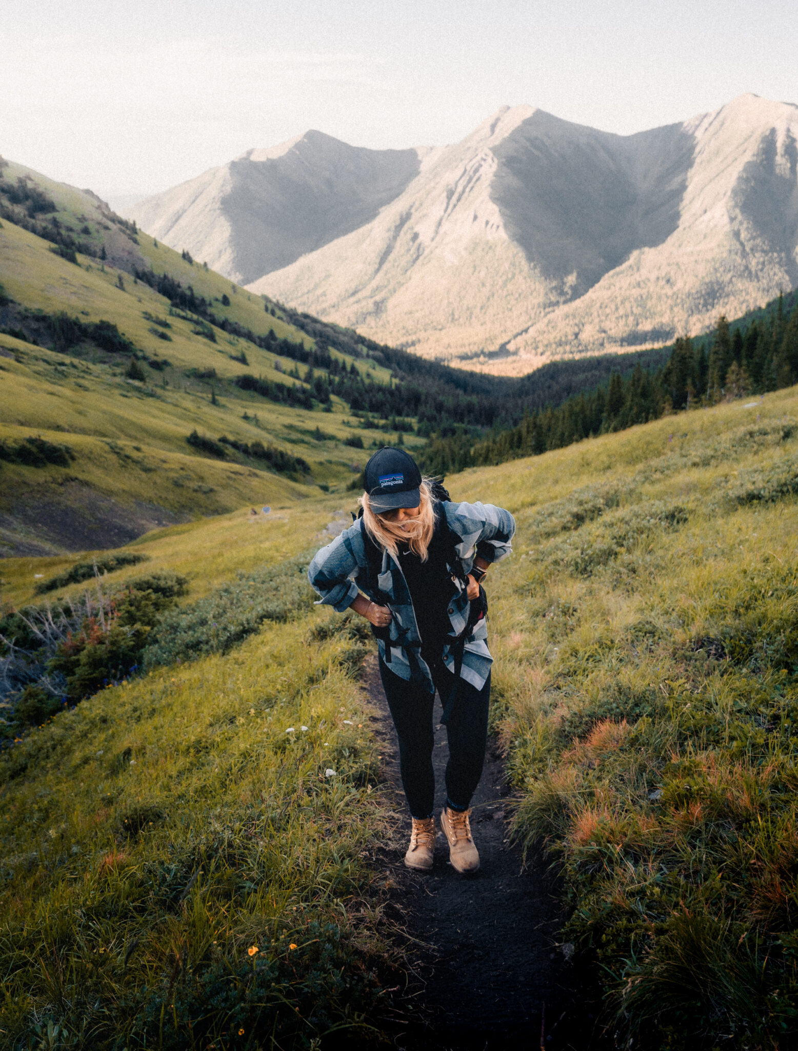
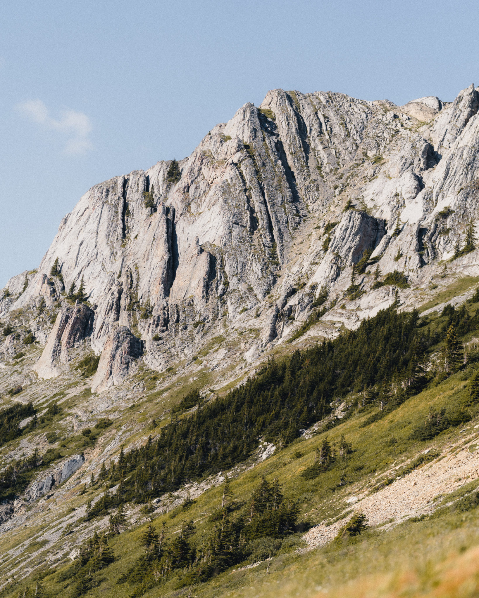
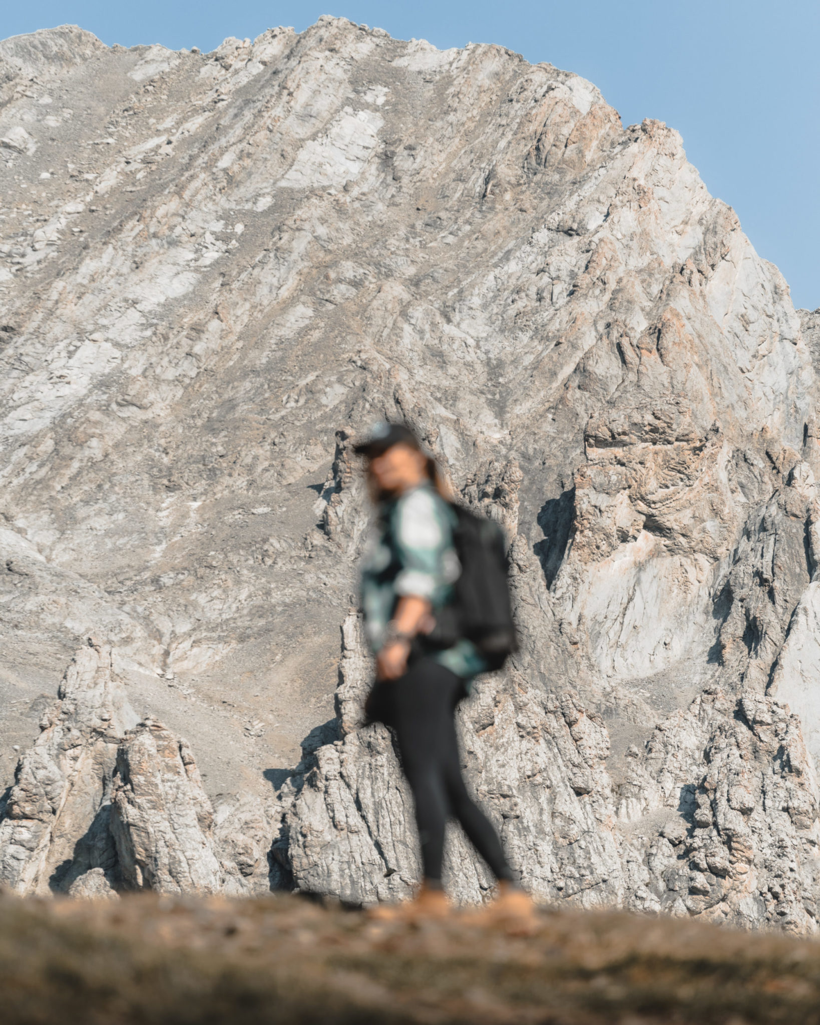
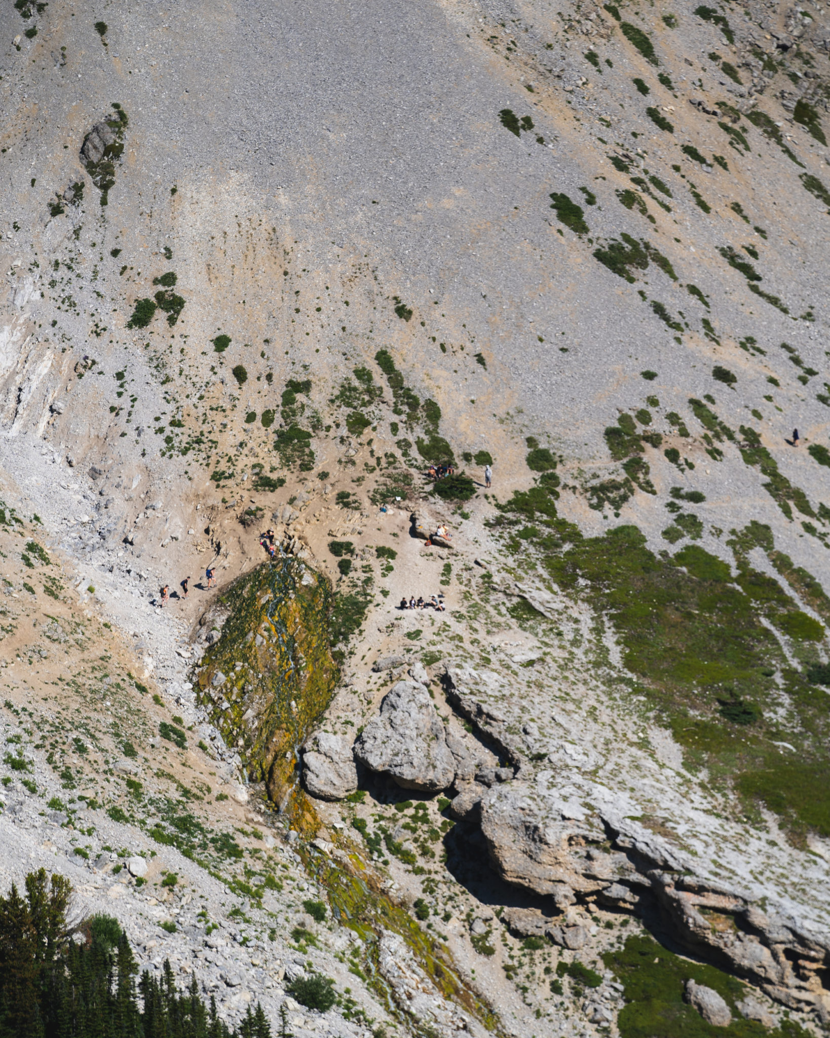
Once reaching the highest peak, you get some awesome views of the valley below as it stretches onwards to the East. When standing on the peak, straight across, in the 10 O’clock position, you may be able to spot a section on the rocky cliffs that’s a bit greenish. The springs are located at the top of that. The hike from the peak to the springs may pose a little bit of a challenge to some. But, it’s only a few sections of this trail that need to be taken slowly and with ease and that is at the beginning where there are larger rocks and at the very end where the terrain is steep and has loose dirt and rocks. For experienced hikers, this isn’t that much of a challenge, but for a novice, this may have its challenges, but honestly, it’s not that bad.
There are a few bushes just before the steep section that is ideal for changing in and out of your swimwear – if you haven’t put it on before the start of your hike and wish not to wear it on your descent back. It would be ideal to have a spotter watching to see if anyone is approaching from behind as this is right in the middle of the trail.
The Springs:
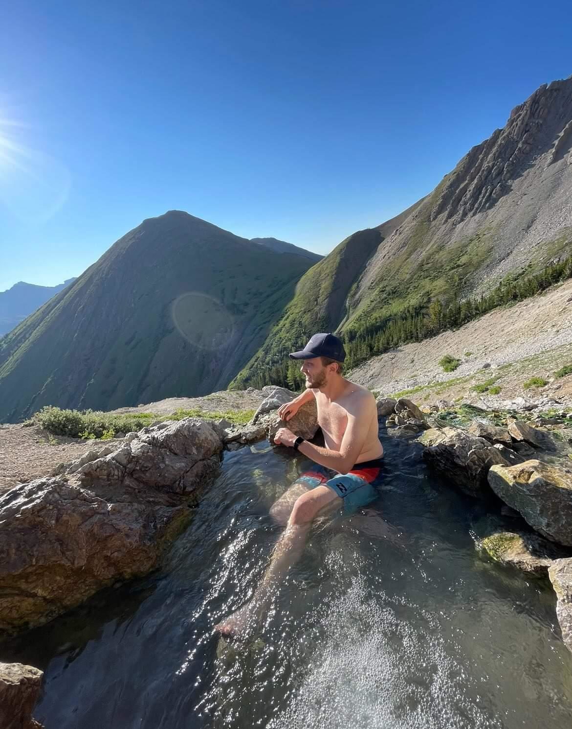
Even though they are called hot springs, I wouldn’t really call them hot by any means. If anything, they are just warm. So, don’t expect to take a dip in the springs if taking a hike here in the colder climates as it certainly won’t keep you warm.
There are two pools, an upper and a lower pool. The upper pool is filled with water flowing through a hole in the mountain, flowing down into the pools, overflowing and filling up the lower pool. The upper pool is small, fitting 1-2 people at most. It is a little uncomfortable as there is a large awkwardly shaped rock in the middle. The lower pool is a little larger, fitting 2-4 people. Both pools are shallow, being about knee-deep at the deepest.
The springs are located on a steep slope, making it difficult to get in and out of the pools. Having a good pair of grippy sandals to wear is ideal as you won’t have to stand on sharp rocks and fight for balance.
The Reward:
If you end up going on a day when no one is around, you can enjoy beautiful views of the valley as you relax in the springs. But, this is rare as this place is usually full of people waiting their turn for a dip. And if you’re here for the sunrise, it’ll be even better as the sun rises right in front of you.
Tips:
It’s best to hit this trail early in the morning for sunrise as there will be fewer people. You will not have to wait as long, if at all if you go early. On our hike back, which was around 9:00 am, we passed by about 50+ people who were on their way up to the springs. Wished them all good luck getting a turn in the pools.
Key Notes:
- The springs become easily crowded, and occasionally having to wait a long time for your turn.
- A Kananaskis Park Pass is required – Separate from the National and Provincial Parks Passes
- Highway 40 through Kananaskis closes in the winter between December and June, so it’s only accessible in spring, summer, and in fall.
- This trail region is known to close several times throughout the year, especially in the spring and fall due to grizzly bear sightings. Remember to check ahead of time on the Kananaskis page for more info on trail closures.
- There is no cell phone service in this region